Description
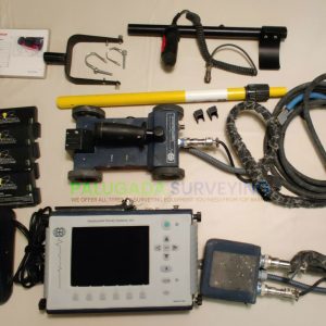
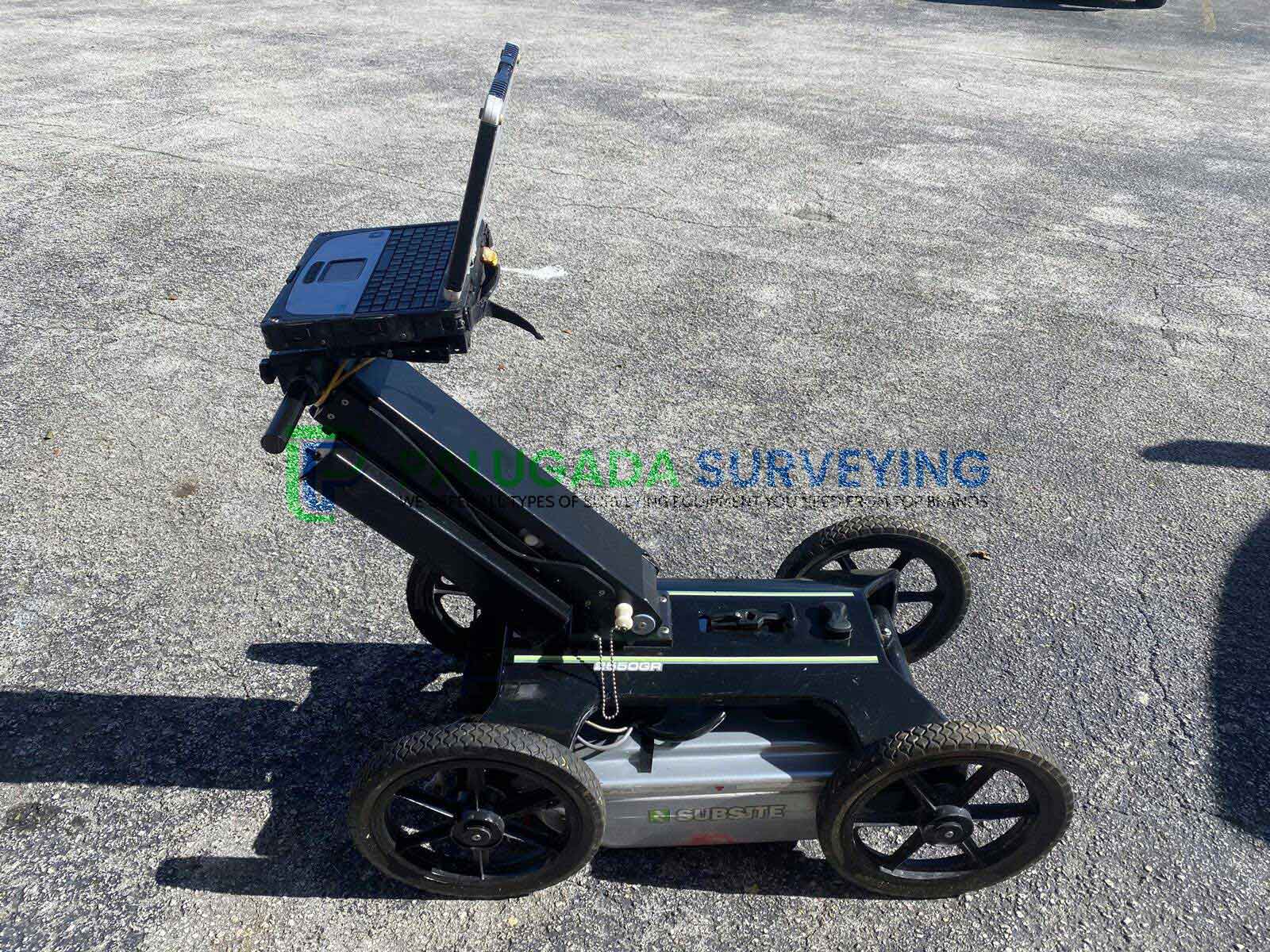
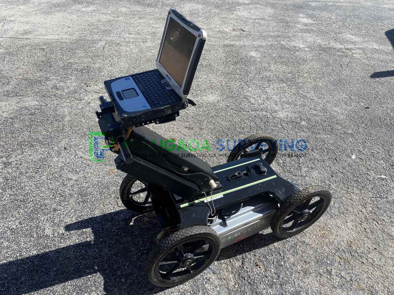
Subsite 2550GR Ground Penetrating Radar for sale with Panasonic ToughBook.
This Subsite 2550GR GPR system will help you locate any type of utility conduit or piping—metallic or non-metallic, including PVC—beneath soil, rock, pavement, and other surfaces.
Subsite 2550GR GPR sale includes;
- Subsite 2550GR
- PANASONIC CF-19 Toughbook
- charger
- battery
- Ethernet Cable
- User Manual
Subsite 2550GR Ground Penetrating Radar
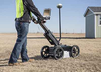 Subsite Electronics introduces the 2550GR Ground Penetrating Radar System featuring a new, user-friendly Window’s-based interface that will provide operators with a number of productivity enhancing benefits. Improved software features include easier integration of GPS data and wireless connectivity that enables users to download web-based maps such as Google Earth. Building upon the proven 2450GR, the new 2550GR is ideal for locating any type of utility conduit or piping—metallic or non-metallic, including PVC—beneath soil, rock, pavement, and other surfaces.
The 2550GR’s user-friendly Windows-based interface provides productivity-enhancing benefits for every jobsite. It offers easy integration of GPS data, reliable wireless connectivity for downloading web-based maps such as Google Earth, and the ability to sweep both deep and shallow objects simultaneously. The versatile 2550GR is ideal for utility mapping efforts, plus void and sinkhole detection, concrete detection, and locating underground storage tanks.
Key Features
- Easy GPS connectivity allows you to see your path and marks in real-time as you scan and the wireless connection allows you to download maps such a
- Google Earth. One-touch recalibration button lets you transition from one scanning surface to another quickly and easily.
- Assisted grid capability allows you to grid your location digitally without having to paint the ground.
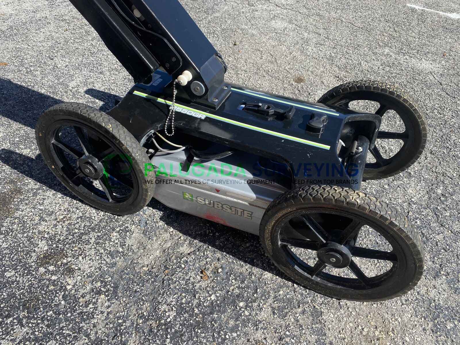
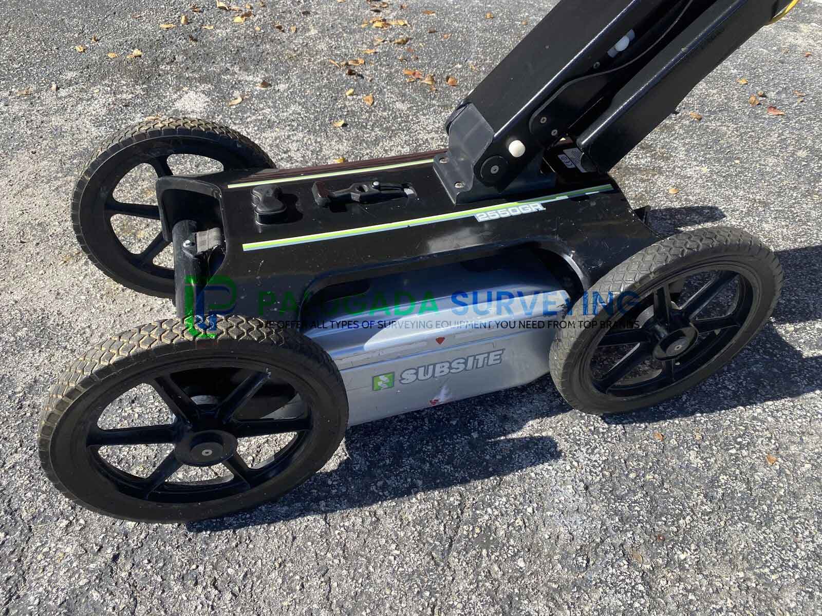
- Locates both metallic and non-metallic pipes and cables to allow one-pass locates at depths of up to 19.7 feet (6 m), depending on soil conditions and antenna selection. Earth-engaged antenna provides better contact on uneven terrain and reduces signal loss.
- With 5.6 mph (9 km/h) survey speed and digitally controlled radar, the 2550GR provides fast, clear images.
- Dual-frequency antenna simultaneously sweeps in two frequencies; this allows you to see both deep and shallow objects simultaneously.
Applications:
- Utility Locating & Mapping – Identify and map underground pipes, cables, and conduits to prevent accidental damage.
- Construction & Engineering – Perform pre-excavation surveys to assess subsurface conditions and avoid costly errors.
- Environmental & Geological Surveys – Detect voids, sinkholes, groundwater levels, and contamination zones.
- Archaeology & Historical Preservation – Locate ancient structures, burial sites, and artifacts with non-invasive scanning.
- Roadway & Pavement Assessment – Evaluate subsurface layers, voids, and structural integrity without damaging surfaces.
- The Subsite 2550GR Ground Penetrating Radar is an essential tool for professionals who need fast, accurate, and non-destructive subsurface imaging.
- Whether you’re locating utilities, assessing ground conditions, or conducting archaeological research, the 2550GR delivers precise, reliable results in real-time.
SYSTEM
- Survey path width 19.68 in 500 mm
- Recording channels 2
- Transmit pulse frequency 200 kHz
- Typical antenna frequency 250 and 700 MHz
- Typical collection speed (scans/second) 100
- Typical collection speed at 2-in (5-cm) sampling interval 5.6 mph 9 km/h
- Display mode Gray scale/color palette
- Zoom Up to 4x
- Data storage Laptop hard drive
- Profile length, max Virtually unlimited
- Stored data format Raw data (for further data analysis)
- Setting of GPR propagation velocity (to get accurate evaluation of depth of detected targets)
- Ground truth or hyperbola fitting methods
- Reading of pipe position/depth Software cursor
- System output Printable radar map with descriptor of detected utilities
- Diagnostic Radar and power supply status, excessive speed, data loss
- Languages English, French, German, Spanish, Italian, Portuguese, Chinese
- Data collection type Parallel profile lines, perpendicular to the expected orientation of utilities
RADAR POWER REQUIREMENTS
- Battery operating time <10 hours
- Power supply 12V sealed lead acid, 12 Ah
MECHANICAL
- Operating temperature 14-104°F -10-40°C
- Humidity 100% (sealed)
- Weight, w/out battery or PC 60.6 lb 27.5 kg
- Weight, w/out PC 68.6 lb 31.1 kg
- Weight, total 73.9 lb 33.5 kg
- Width 21 in 533 mm
- Length, handle fully extended 49.92 in 1.27 m
- Length, folded 39.96 in 1.02 m
- Height, handle fully extended 39.48 in 1 m
- Height, folded 20.4 in 521 mm
DUAL FREQUENCY
- Antenna technology Ultra-wide band, ground coupled, shielded dipole
- Typical range .32-8.2 ft 0.1-2.5 m
- Range, max .32-19.7 ft 0.1-6 m
RECOMMENDED PC SPECIFICATIONS
- Processor: Intel® Core™ i5 1.9 GHz (minimum: Intel® Core™ i3 1.7 GHz)
- RAM: 4GB (minimum 1GB)
- Intel HD Graphics 3000 or nVidia graphic adapter compatible with OpenGL 2.1 or newer (minimum: graphic adapter compatible with OpenGL 2.1)
- Screen Resolution: 1024 x 786
- Operating System: Windows 7 (32bits)
- Shock Proof Hard Disk Drive
- Serial Port RS 232 (only used with the GPS)
- USB Port (minimum: Ethernet port)
GPS REQUIREMENTS
- The 2550GR system can be used with a GPS to position the scans in real time without the need of creating a grid.
- Requirements are: Dual frequency (L1+L2)
- Positioning update greater than 5 Hz
- RTK: connection to a base station via radio link (UHF or GSM) or connection to a
- Continuously Operating Reference Station (CORS) via internet
- NMEA output
- Serial cable (RS232) or Bluetooth® connectivity