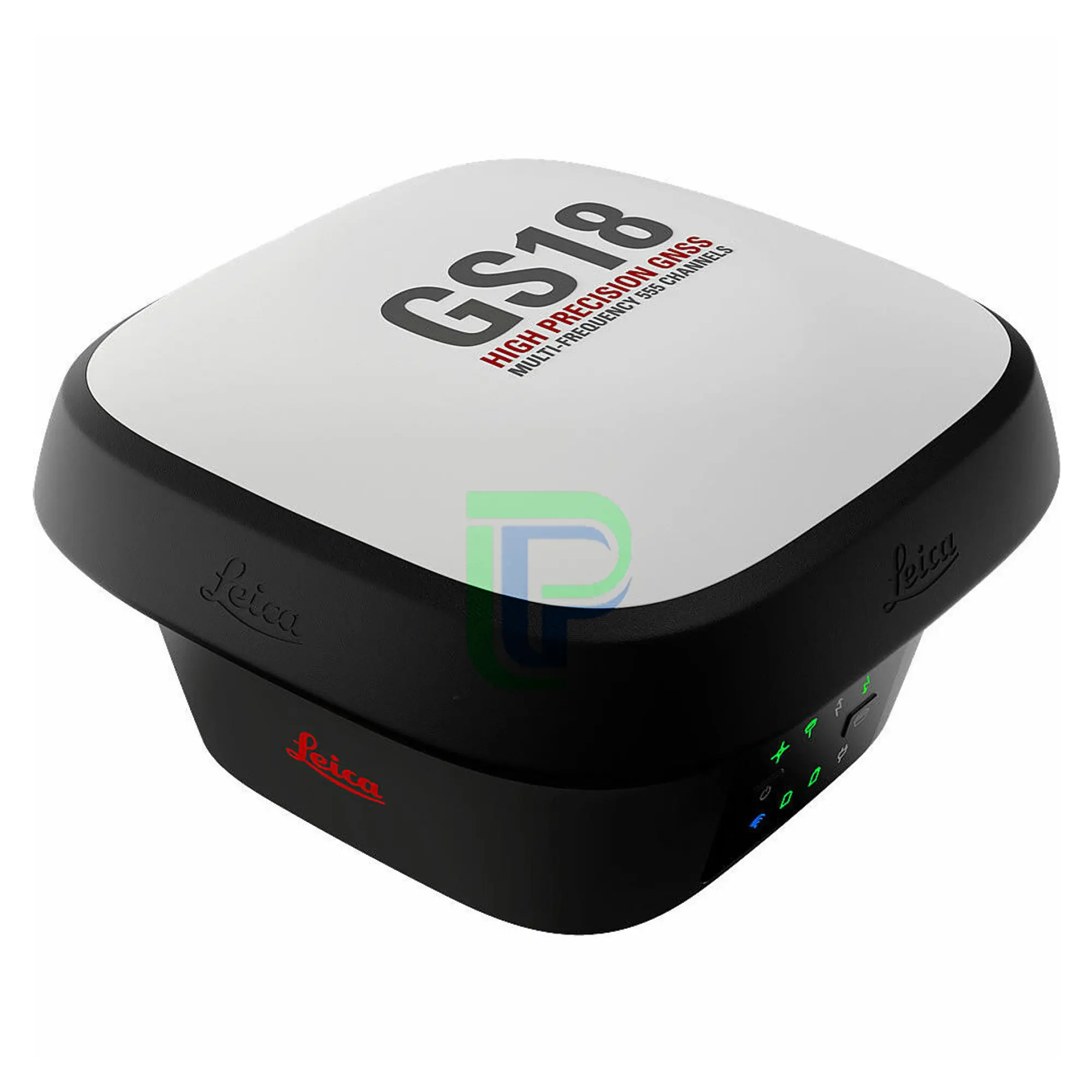

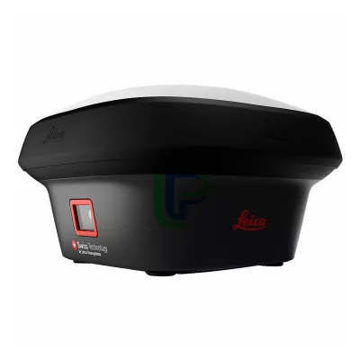
Leica GS18 I GNSS RTK Rover
Leica GS18 I GNSS RTK Rover with Visual Positioning redefines what an RTK rover is capable of. Designed for surveying professionals to measure points with a GNSS rover easily and accurately, quickly capture the site in images and measure points
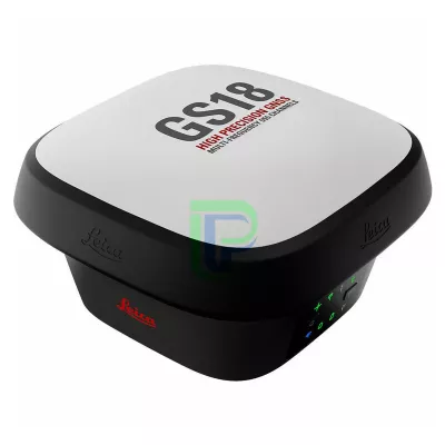
Leica GS18 I GNSS RTK Rover
Leica GS18 I GNSS RTK Rover with Visual Positioning redefines what an RTK rover is capable of. Designed for surveying professionals to measure points which previously could not be measured with a GNSS rover easily and accurately, quickly capture the site in images and measure points.
Package includes:
Leica GS18 I GNSS SmartAntenna
- Leica GS18 I LTE & UHF Unlimited SmartAntenna, LOP60 GLONASS Option
- GEB334 Li-Ion Battery x2
- GVP743 GNSS Rover Container
Leica CS20 LTE Field Controller
- GEB334 Li-Ion Battery x2
- MSD1000 SD Memory Card 1GB
- GHT63 Pole Clamp
- GHT66 Holder Plate for CS20
Accessories
- GKL341 Charger
- GLS30 GNSS Telescopic Carbon-fibre Pole
Applications
- Leica Captivate Measure & Stakeout CS20
- Leica Captivate Worksite+ for CS20
- (Ref Line / DTM Stake / Volume Calculation)
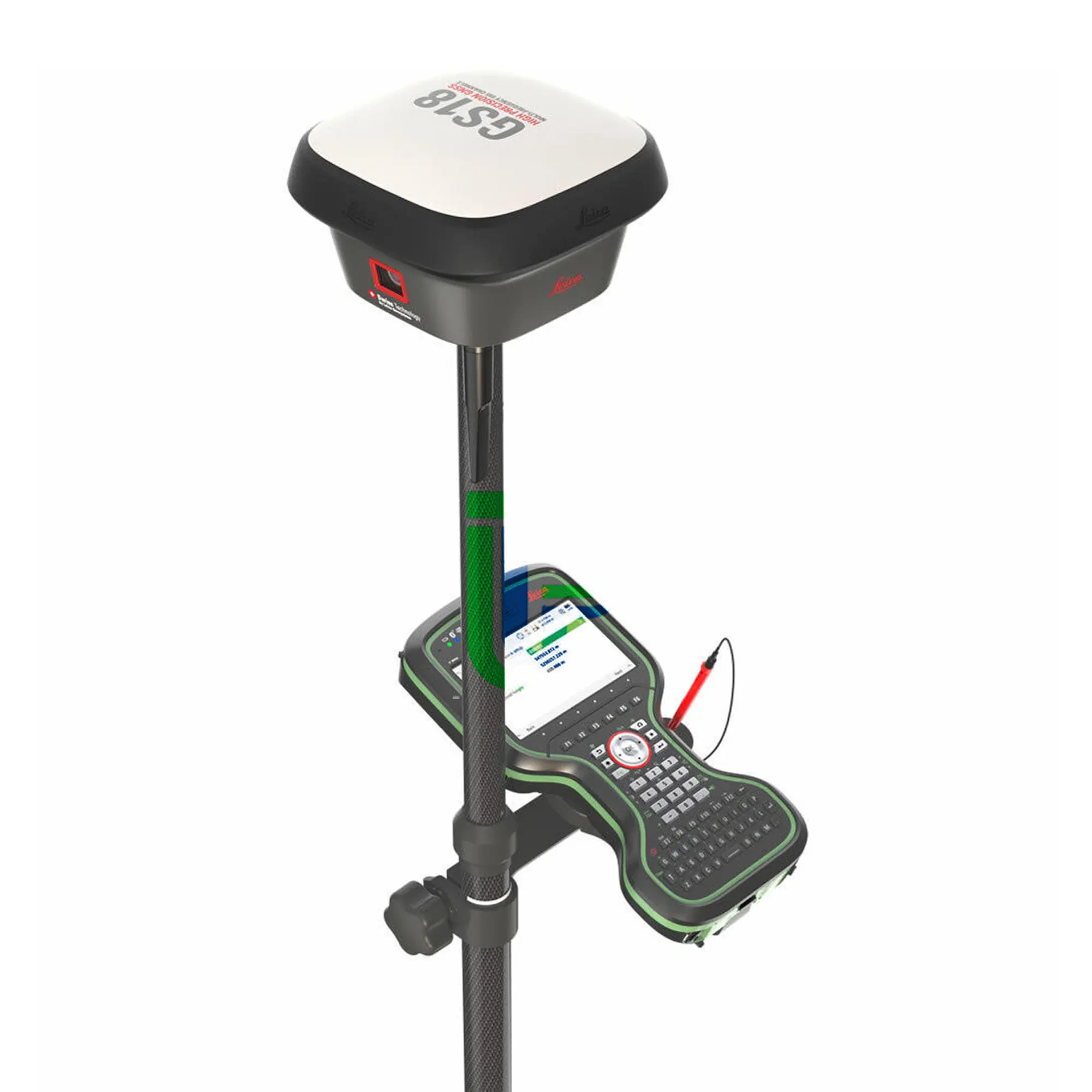
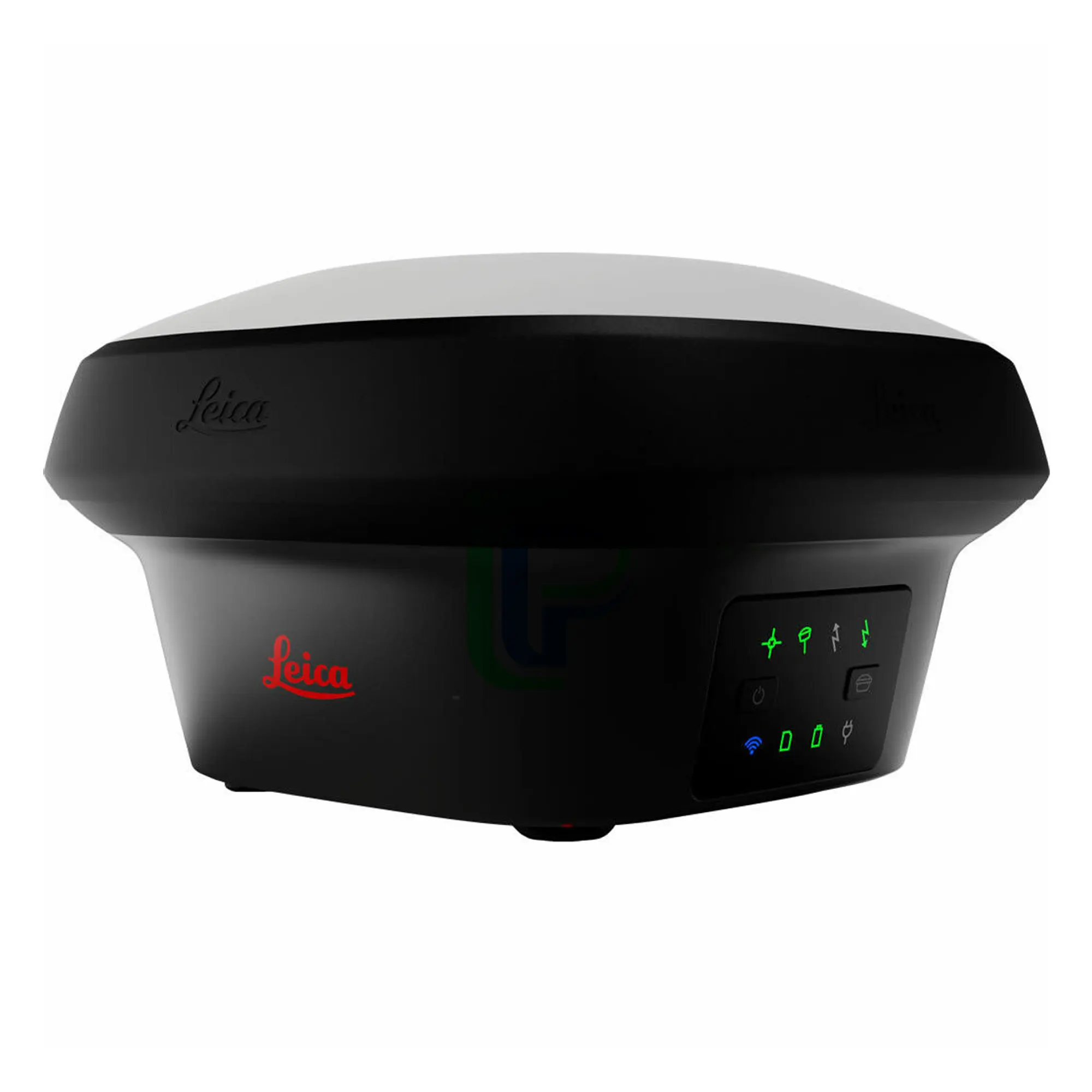
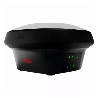
Leica GS18 I GNSS RTK Rover with Visual Positioning
Introducing Leica GS18 I, a versatile, survey-grade GNSS RTK rover with Visual Positioning. Designed for surveying professionals to measure points which previously could not be measured with a GNSS rover easily and accurately. Now, you can quickly capture the site in images and measure points from them, either in the field or later in the office. For GS18, I means imaging.
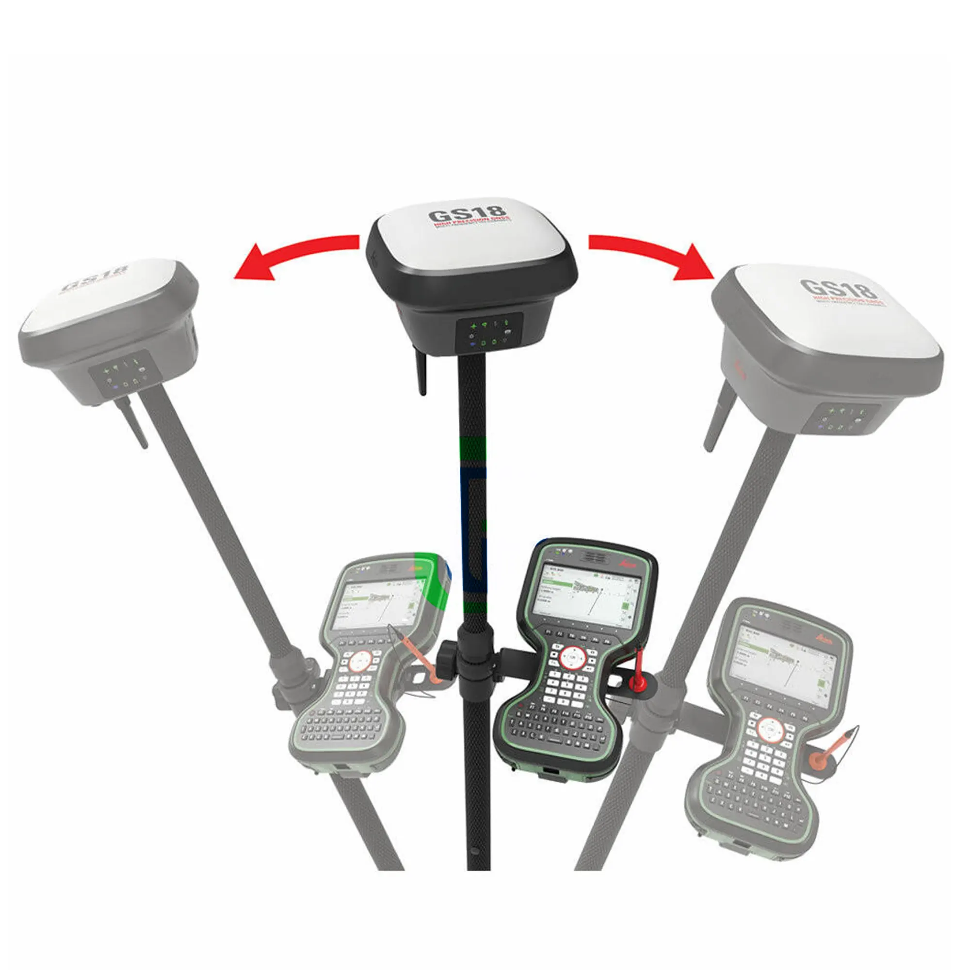
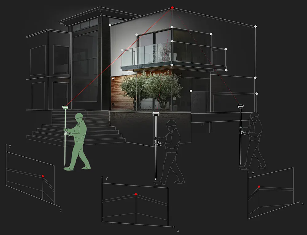
Sensor fusion of GNSS, IMU and a camera come together to create Visual Positioning technology, resulting in a GNSS RTK rover so powerful that it enables you to measure what you see. GS18 I has all the functionality of the Leica GS18 T: in addition to Visual Positioning, users can for example map points with either tilted or levelled pole.
- Measure points with obstructed view to the sky more efficiently and easily.
- Capture points you couldn’t reach before with a GNSS rover.
- Gain more flexibility and control, with no need to use additional time-consuming equipment.
- Map hundreds of points with survey-grade accuracy within minutes.
- Capture the scene quickly and decide later, what should be measured – even if the scene subsequently changes or disappears.
- Tap on an image to measure a point in the field or in the office.
- Quick and thorough so you catch every detail.
Visual Positioning
The GS18 I matches the same intelligent tilt technology of the GS18 T and the advanced signal tracking capabilities of the smartest GNSS antennas—but the GS18 I takes another step forward in technological innovation. With the new addition of an imaging sensor, the GS18 I lets you perform photogrammetric measurements on the fly. Its cutting-edge implementation of sensor fusion empowers you to take your efficiency to a whole new level and at the same time overcome traditional GNSS obstacles such as measuring under a building canopy, dealing with multipathing and even performing vertical measurements of facades, all without resorting to costly alternative measurement options or putting yourself in harm’s way
Innovative
GS18 I is an accurate and easy to use GNSS RTK Rover. It utilises highly innovative Visual Positioning technology based on seamless integration of GNSS, IMU and a camera. It enables you to measure points in survey-grade accuracy from images either in the field or in the office. Alternatively, create point clouds from captured images using Leica Infinity to expand possibilities even further.
Fast
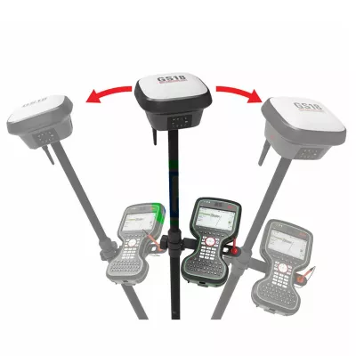
Designed to measure a large number of points efficiently. The GS18 I allows you to capture images and measure hundreds of points within minutes with no need to physically reach the point. Time spent on-site is reduced and revisits minimised - once the site is captured, you can measure all detail whenever you want to.
Versatile
Imaging power has changed the rules of the game. By having the power to measure what you see, you can now reach places you couldn’t before without the need to switch tools or climb through obstacles. This gives you flexibility in the field, frees up equipment and crews, truly maximises productivity, and increasing profits.
ENGAGING SOFTWARE
The Leica Captivate field software is the perfect companion for the GS18 I. With easy-to-use apps, all measured and design data can be viewed and used, providing you with a clear understanding of your data in 2D and 3D view. Captivate spans industries and applications with little more than a simple tap, regardless of whether you work with GNSS, total stations or both.
TILT COMPENSATION
Based on sensor fusion of IMU and GNSS, GS18 I’s tilt compensation is immune to magnetic disturbances and it works immediately without calibration. With the GS18 I, surveyors have the flexibility to measure points with a levelled pole and still save the tilt values of each measurement. That way you have the trust that what was measured, is correct.
INTERNAL MEMORY
Users with any GS18 model have the flexibility to log raw data into an SD card or the internal memory.
4G LTE & EXCELLENT MEASUREMENT QUALITY
Tracking multi-frequency signals comes as standard with all Leica Geosystems GS sensors. Combined with an excellent GNSS antenna element and a position update rate of 20 Hz, GS18 I ensures reliable measurement quality.
IMPROVED PERFORMANCE
Multipath reduction and interference mitigation options in Captivate boost GNSS signal tracking quality under harsh environments, which improves RTK availability and accuracy. Also, an interference toolkit will enable filtering to remove in- and out-of-band distortions for even more robust GNSS signal tracking.
ACTIVE CUSTOMER CARE
Through Active Customer Care (ACC), a global network of experienced professionals is only a click away to guide you through any challenge. Control your costs with a Customer Care Package (CCP) which gives you peace of mind you are covered anywhere, anytime.
Reference: